|
||||||||||||||
|
HOME > Outdoors Home > Trip Reports Grand Canyon Rim-to-Rim-to-Rim Run - November 03, 2007
Quick Details:
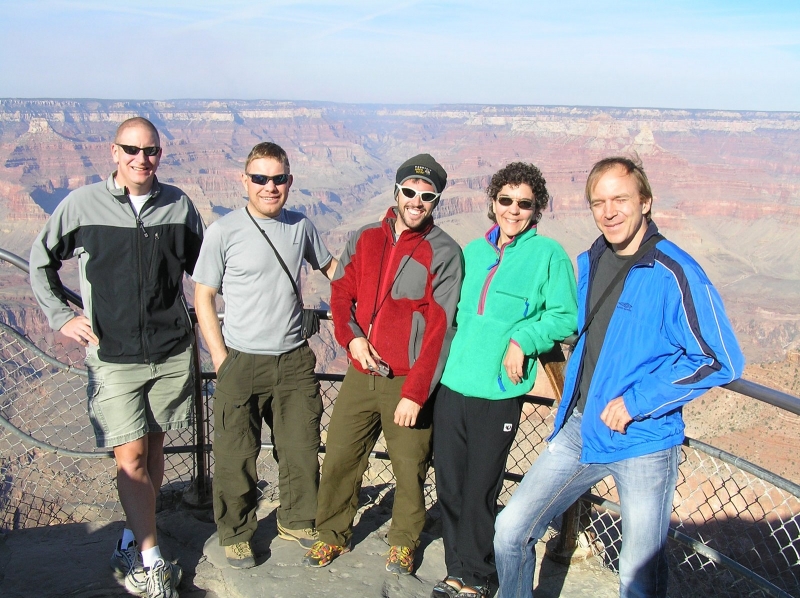
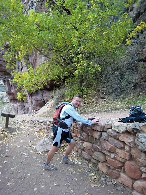
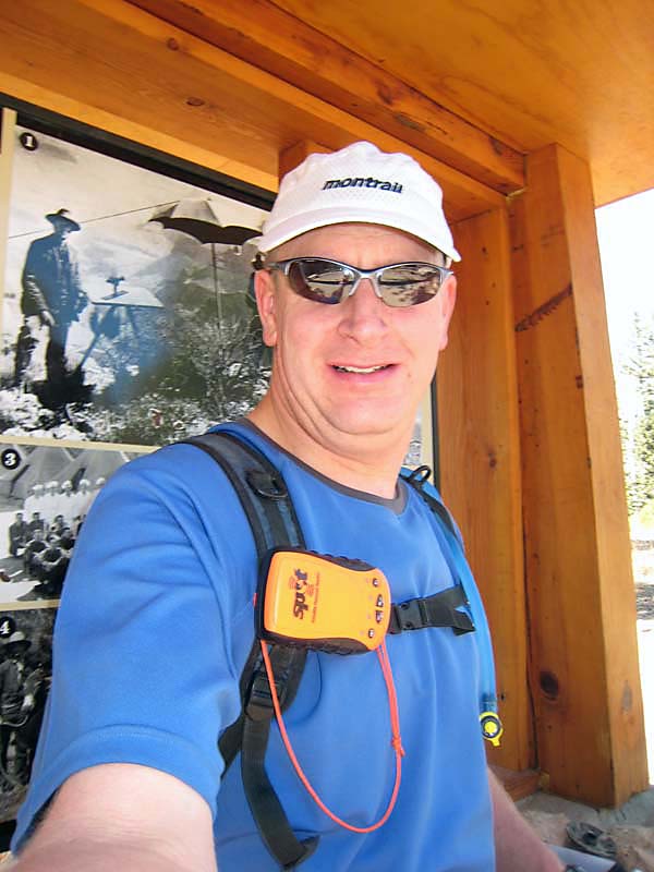
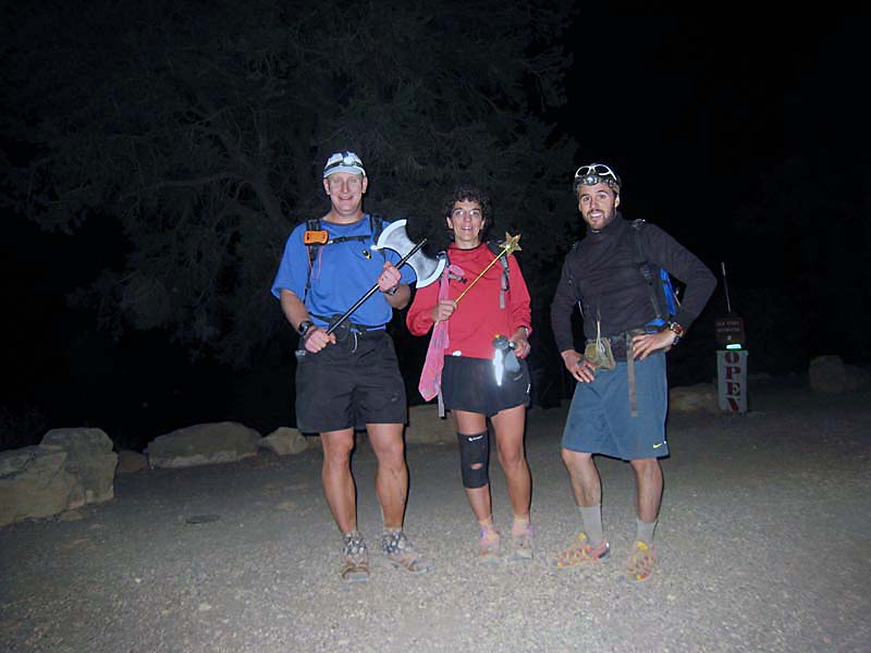
The Special Idiots decided to make another run at the Grand Canyon R2R2R, after our heat-stroke-fest last May. We picked early November this time, with the hope we'd have much cooler weather. We picked right, as the weather this time was perfect! For this trip, we had 8 people lined up in two cars: Boulder crew: Jonas Fast, Fritjof Fagerlund, Kari Fraser, me, and Ben Smith. From Estes Park: Michael Hodges, Michael Poland, and Alan Smith. I was beta testing a GPS personal locator beacon, called the SPOT, on this trip. The company wanted to see how well it worked in a deep canyon. The beacon sends your location to a pre-determined email list, which allowed Susan and others back home to track our progress in real time. It looked like a pretty cool product and I was interested in seeing how well it worked.
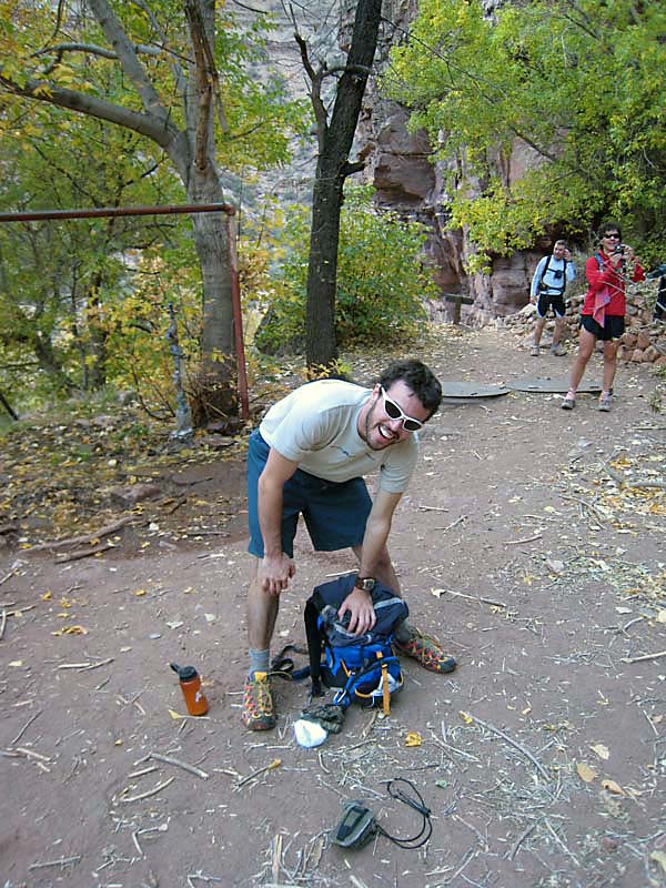
The Boulder crew left about 7:30pm Thursday and stopped in Moab for the night. The next morning we woke up early and finished the drive, arriving at the Grand Canyon about 2pm. We visited some of the overlooks and made our way to camp. The Estes crew showed up not long after us, we bumped into them in the General Store. We all made dinner, packed up for the run, and headed to bed. The Boulder crew intended to get an earlier start than the (faster) guys from Estes. We planned to get up at 2am and head out about 3am. They were getting up and 3am with a goal of being on the trail about 1/2 hour behind us.
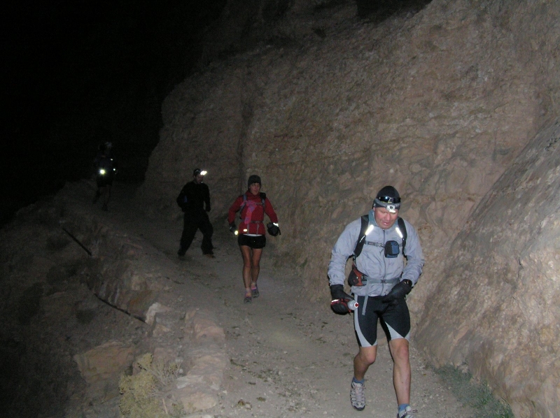
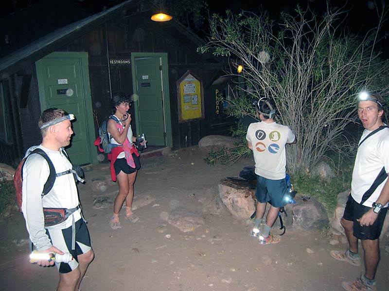
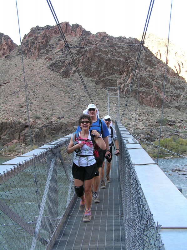
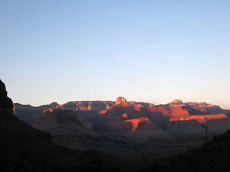
We awoke about 2:15am, ate, packed up, and headed out. This time around we decided to run from and back to the campground to make it a little more than 50 miles. We pushed off a little after 3am and headed to the far end of the Mather Campground where we cut through the woods and came out on the highway. We ran easy down Hwy 64 to Yaki Point, were we met up with our fate and the South Rim at the South Kaibab trailhead. At 3:51am we dropped into the dark Abyss of the South Kaibab Trail. The run down the South Kaibab was mellow and relaxing. We arrived at the Phantom Ranch mess hall 1:37 after we started. Here we took a break, sent some Help messages with the SPOT, fueled up, and headed out. It was a pretty long break... approaching 30min.
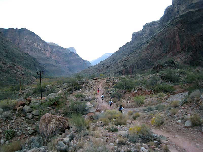
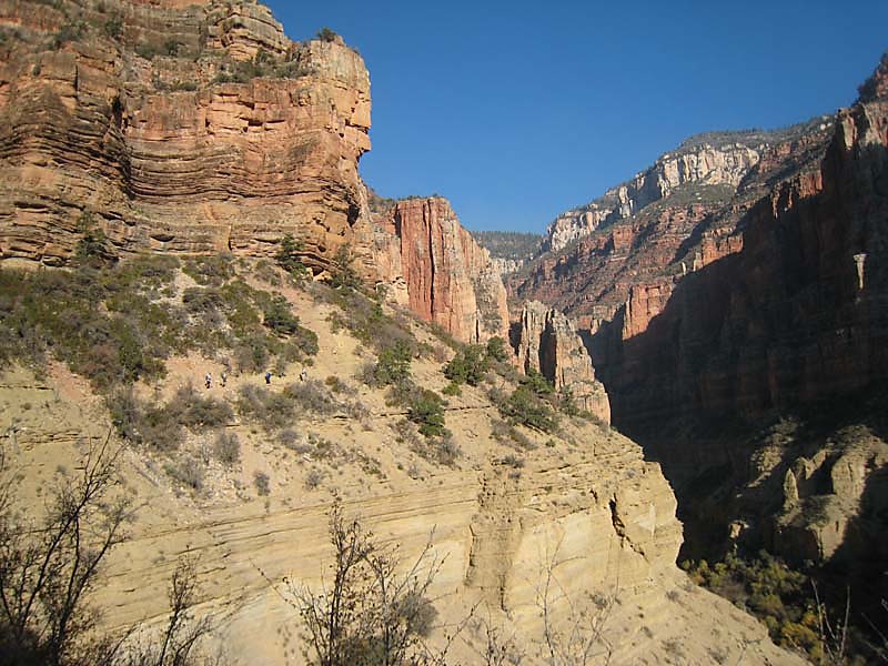
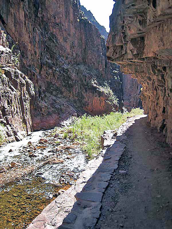
We left Phantom Ranch, still in the dark, and headed into the "Box". The Box is narrow gorge carved through the deep Vinshu Schist by Bright Angel Creek. While not a slot canyon, it's very narrow and fun to run in (at least going out). I first started smelling the smoke from the controlled burns early in the Box. It smelled like a campfire and was only mildly irritating in the back of one's throat. The gradient is steadily uphill, but at a very low angle, so the entire stretch is runnable. Jonas took the lead through here and set a nice steady pace the entire way. We left the Box after about 4 miles and ran into a more open canyon and into the sunrise. It was a beautiful morning and the temperature was perfect!
The next 2.5 miles to Cottonwood Campground went quickly and we arrived at Cottonwood about 3:50 after starting down from the South Rim. Our pace was steady but we weren't breaking any records... perfect for my big carcass! We took another long break at Cottonwood where we ate and stashed extra gear in the food bins there. We'd pick that gear up (food, flashlights, etc) on our way back through later in the day.
We pushed off from Cottonwood and ran up to the Roaring Springs caretaker cabin at the base of the very steep climb up the last 6 miles to the rim. The Backcountry Office had let me know, via email, that the water had been turned off for the year at the caretaker's cabin. The water was still on, much to our surprise, so we filled up our camelbacks and handhelds to prepare for 4 or so hours of no water from here to the North Rim and back.
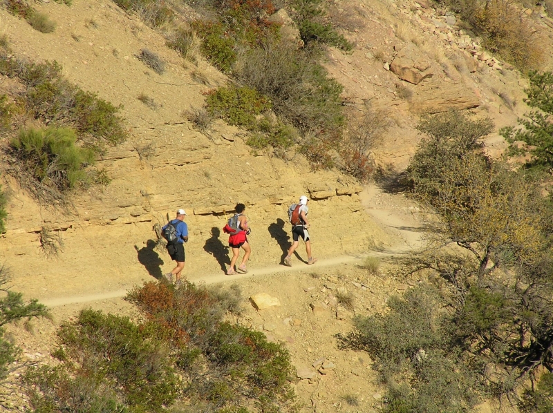
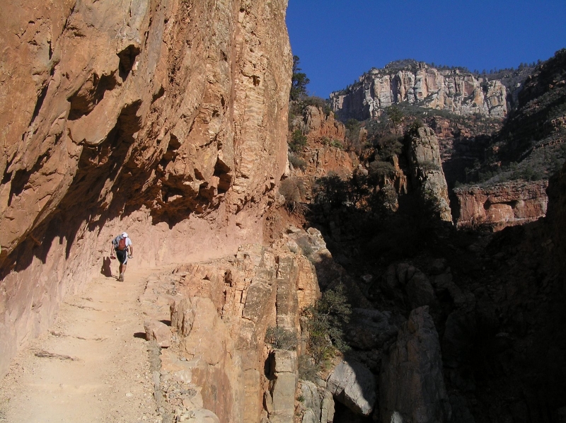
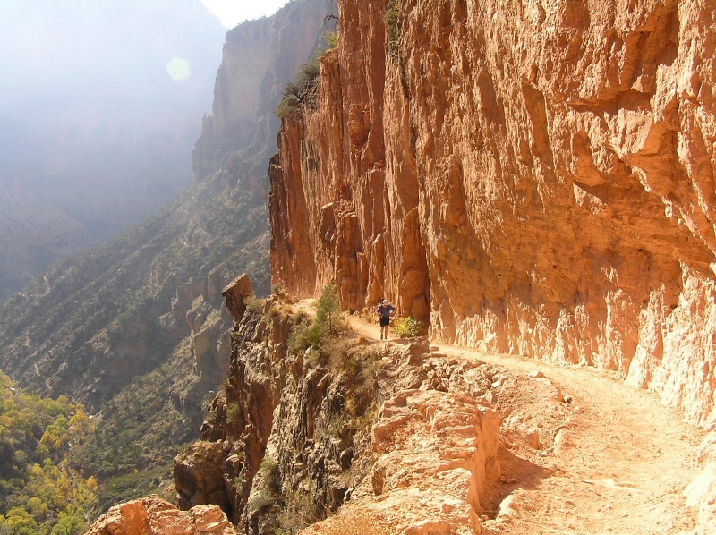
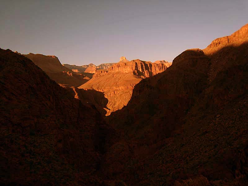
Immediately after the caretaker's cabin the trail changes demeanor and becomes much steeper as it climbs out of the Roaring Springs Canyon through geological history to the North Rim. This is, in my opinion, the most beautiful part of the entire run. The North Kaibab hugs the edges of high cliffs and is often blasted right out of the side of these cliffs. We kept a nice pace for the first few miles and we started running into the first R2R day hikers headed south near the Roaring Springs turnoff. My quads really started to cramp at this point and it seemed I had developed quite an electrolyte imbalance. I started popping Endurolytes, 3 at a time, every 20-30 min or so to combat this. The rest of the group was feeling strong and they ran on ahead of me near the bridge over Roaring Springs Canyon, at the junction of the Redwall and Supai formations (about 3 miles from the North Rim).
The next 3 miles was a death march for me. I kept eating, drinking, and popping Endurolytes like candy (I wound up taking 19 over a 2 hour period before I got back to homeostasis. My pace dropped WAY off and I saw the rest of the crew heading into the Supai Tunnel as I was just climbing the first few switchbacks. Uhhgg... looks like I was headed for yet another long death march in the Grand Canyon! I reached Supai Tunnel and took a long break to rehydrate and take more electrolytes, then I headed up. A group of 4 women running a double crossing passed me at Supai. Kari passed me on the way down, just above the Coconino layer. Fritjof, Jonas, and Ben passed me about 300yds from the North Rim. They had waited for about 30 min for me then decided to head out. I passed the battle axe to Ben, as I wasn't feeling worthy of it anymore. I finished out the climb and arrived on the North Rim 7:22 after leaving the South Rim. I took a quick break of about 5 minutes and started back down. We were all planning to regroup at Phantom Ranch.
The legs started to feel better on the descent and I was able to run all the way back to the caretaker's cabin. Here I filled up on water again and ate a HammerGel and a Lara Bar. Things were starting to heat up down low in the canyon and the next two miles to Cottonwood was warm. At Cottonwood, I picked up my gear and talked to a couple of guys doing a R2R2R. They said "dang, you're making great time... did you start at 11pm or midnight?". I looked at my watch and said "9:10 min ago". They said something along the lines of "Holy shit!". We chatted for a bit about the conditions and water status further up the trail and then I bid them good luck and headed out. The next 7 miles, back to Phantom Ranch, always sucks. This stretch always seems to take the same time, whether I'm headed up or down. Once you enter the Box, if "feels" like you should be close, but it's still a LONG flat-ish run for another hour or so. The final bridge-pair in the Box came in to view and I knew I was close. After another mile or so, I rejoined the rest of the group at Phantom.
When I met them, they were lounging in the shade enjoying the day. Kari and I grabbed a couple glasses of the world famous Lemonade at the Phantom Ranch canteen. It was really really good! We took a little break and then started the final leg of the day: the big climb back out to the South Rim.
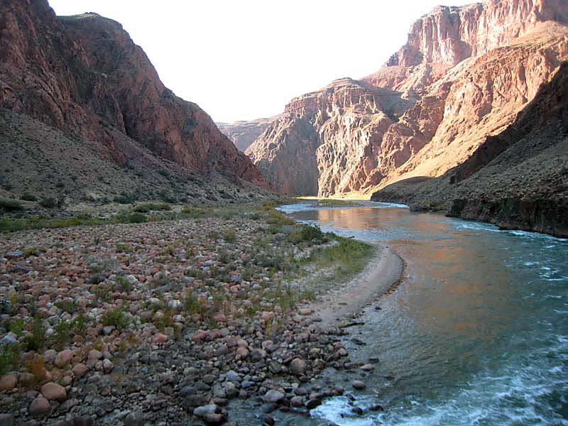
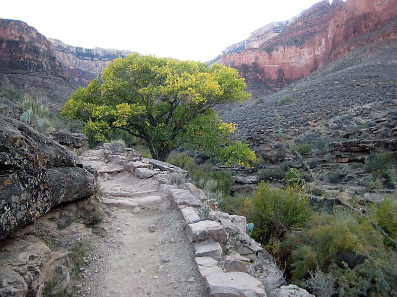
We crossed the Colorado river about 12:30 into the run and ran slowly along the River Trail for the 2 miles to where the Bright Angel trail turns south and heads up the Pipe Creek drainage. Lower Pipe Creek I think would be runnable for some... it was *almost* runnable for us, but not quite. After a short time the trail turned up steeply and we climbed out of Devil's Corkscrew. The Devil's Corkscrew ends at the creek that originates at the springs at Indian Gardens. This is a lovely stretch of trail, probalby 1.5 miles long, that parallels the creek to Indian Gardens. This is probably my favorite stretch of trail on the South Rim portion of the R2R2R... there is lush greenery, large Cottonwood trees, and the ever-present sound of moving water here. This stretch was also not quite runnable for us, but would be for a faster/fitter group. Soon we arrived at Indian Gardens and refilled and refueled for the last 4.5 miles and 3000' to the South Rim.
The last 4.5 miles was hard. Heck, this last climb is always hard and today was no exception! The rest of the group was feeling strong and they pulled away from me again on the climb. I made it to just below the 3 mile Rest House (3 miles to go) and it finally got dark, so I pulled out my headlamp. I could see the lights of the others climbing a few switchbacks ahead of me. Further ahead were even more lights as well as stretched out below me. There were a lot of people on the trail this evening.
Expecting to hike the last 3 miles alone, I was surprised to come around the corner at the 1.5 Mile Rest House and see Kari and Ben sitting on the rock wall waiting. It was very kind of them to wait and much appreciated. I was hitting a low point here, so it was nice to have someone to talk to, to take my mind off the incessant uneven log steps on the trail. We kept a slow steady pace and hit the first of two tunnels in fairly short order. Not long after that we passed through the second tunnel, turned the corner, and saw the old Kolb Art Studios just above us. What a great feeling! We hiked out and reached the trailhead 15 hours and 51 minutes after starting.
Since we were "Special Idiots" we still had the run back to the campground. Ben was keen on the shuttle bus, but we talked him into running it back in. Heck... it was only 1.5 miles. Or so we thought. We stopped after about 1.5 miles, at a bus stop, and checked the map. Uhhgg... we had just over two miles to go still! We decided a warm bus was a pretty nice way to end this run, so we hopped on the next one and rode it back. We got a LOT of unusual stares from the normal clean tourists on the bus! We arrived at the campground only to realize that the showers close at 6pm in the winter. We had missed them AGAIN, this time by about 90 minutes. We all took cold baths in the sinks in the campground and made a nice dinner and retired to bed early.
The next morning we had a great breakfast at the Bright Angel Lodge, grabbed some hot showers, and headed out. The drive home went pretty quickly and we all had a good time playing name that tune with the radio.
This is a really great run. Most would say it's a must-do for the serious ultrarunner. That said, it's very very difficult and should NOT be attempted by those who aren't prepared to run a completely self sufficient 50 mile wilderness run. This is still the hardest 50 I've run, even compared to the recent Moab Alpine to Slickrock 50, which had the same amount of elevation gain. When the North Rim is closed there is no way out... you must come back! When the North Rim is open, it's a 250 mile hitchhike back to the South Rim... these logistics aren't trivial! Rescues in the Canyon are very difficult and very costly. The helicopter bill alone is close to $4000, the last I read.
As a side note: The SPOT locater beacon worked very well. It didn't send signals in the Box and in the narrow section of Roaring Springs Canyon, which I expected (it's GPS based). There were some user interfaces issue I didn't like (but could live with), as some of the navigation isn't intuitive. Overall, it worked very well and I'll actually probably wind up buying one. If anything it's a cheap insurance policy at only $149.
That's it for now... we'll be back in a year or two to try again for that elusive sub-12 hour double crossing!
|
|
Copyright © 2003-2012 - Chris Gerber
|