|
||||||||||||||
|
HOME > Outdoors Home > Trip Reports Epic Colorado Trail run - May 10, 2008
Quick Details:
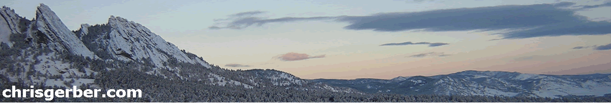
I've been wanting to run the entire Colorado Trail, in segments, for quite some time. This past weekend we were looking for a long run at altitude, so I suggested we run Segment 4 and Segment 5 of the CT. This starts just south of Bailey, off Wellington Lake Rd (FS 560) and ends at Kenosha Pass on Hwy 285. The distance was to be about 31 miles. The weather was forecast to be overcast and 30-50F in the altitude range we'd be running in. Perfect running weather.
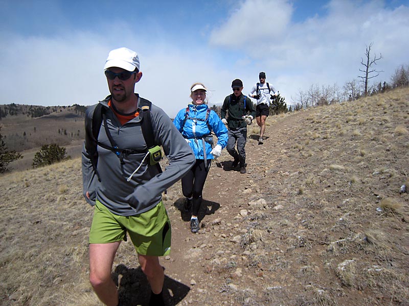
Charles, Tressa, Mike P, and a friend of an acquaintance of Charles' named Joe joined me. No one had ever met Joe until today, but he was a very solid runner looking for some elevation training as preparation for the Leadville 100. We decided to meet at 6am at the Eldo park-n-ride so we could get an early start. Tressa had to be at a function in Denver at 6pm that evening. That should have given us plenty of time to make the drive and car shuttle (about 2 hours), do the run (6-7 hours) and then go straight to her event (about 1 hour).
The day started off wrong because I forgot to set my clock. Luckily, I woke up at 6am and realized I was late. I called Charles and he and the others decided to just wait for me at the park-n-ride. I packed the van quickly, grabbed a couple pieces of toast w/ peanut butter, and headed out. I met Charles, Tressa, and Mike at the park-n-ride, threw my stuff in Tressa's car and we headed towards Golden to pick up Joe. We drove to Bailey, dropped Charles' car at the eastern terminus of our run and then headed towards Kenosha Pass. We decided to run west to east in case there was snow at Kenosha. If there was to be any snow on the trail, we expected it to occur early, near Kenosha Pass.
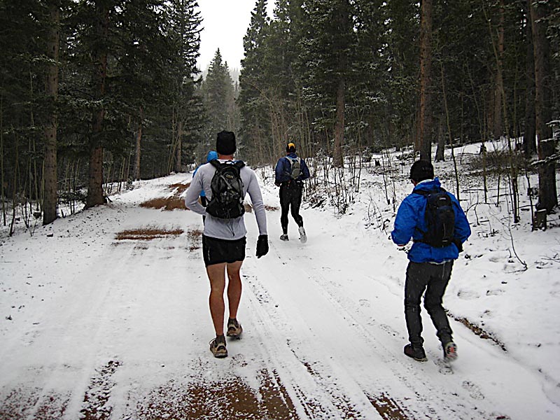
At Kenosha Pass, we got dressed to run and packed our hydration packs. It was overcast and snowing lightly and the temperature was hovering around 35F. As we headed out, we ran into a couple of hikers who told us they were just returning from a short hike on the Colorado Trail (CT). We talked about conditions and asked them the best place to pick up the trail (there are ton of social trails and jeep roads at Kenosha Pass) and they pointed us in the direction they had come from. This was Mistake number 1. We should have consulted the map, because they actually pointed us down the road to North Lone Cone Peak. We headed out and maintained a nice paced jog. After about 4 miles the trail started to switchback very steeply and I knew at that point we were on the wrong trail. A quick consult of the map confirmed this so we found a way to backtrack a mile or two and bushwhack over a low ridge. We dropped down from the ridge and hit the CT and were on our way again. The false start cost us about 4 miles and one hour.
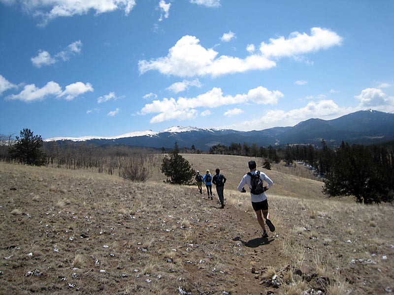
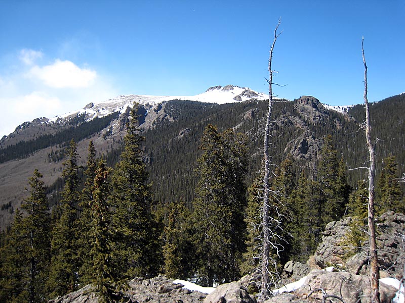
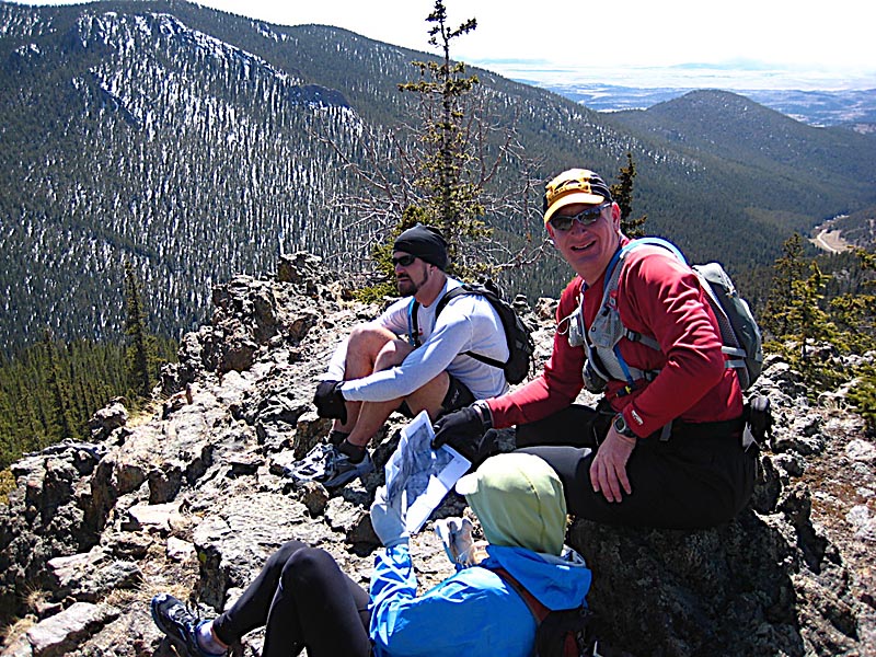
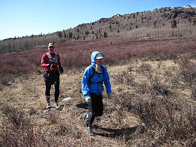
The next 16 miles were uneventful. The running was beautiful, along perfect singletrack with sweeping vistas of the Kenosha Range, Tarryall Range, South Park valley, and the Continental Divide far to the west. We took our time and maintained a comfortable pace and rolled into the Long Gulch trailhead at mile 20 around 5 hours of elapsed time. We stopped here and treated and refilled our water bottles with Joe's SteriPen, which is a very cool water purifier that uses UV light to kill organisms in the water (plus it only weighs 3oz!).
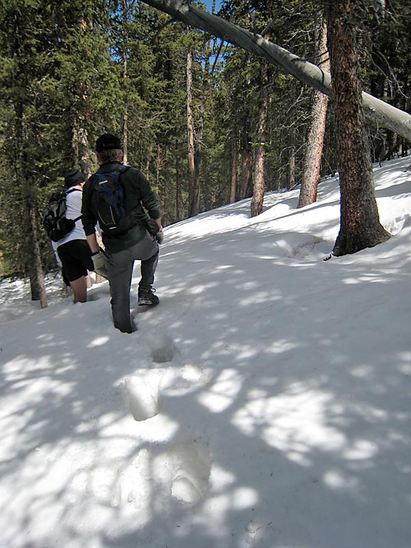
After the break we started the climb up to the saddle that separates Long Gulch from the Lost Creek drainage. This is where mistake number 2 began. We hit snow almost immediately on this shaded north facing slope. It was a short climb, so we pushed on through knee and thigh deep snow and contoured around the hillside and the snow faded away. As we continued the climb we again found ourselves on the north side of Point 11,130' and in very deep and unconsolidated snow. After struggling for 15 minutes to gain 100 or so feet, we decided to bushwhack up to the top of the ridge to our south and follow that ridge up and over the summit of Point 11,130' The extra 500' of elevation gain would be well worth it, to avoid the deep snow. This strategy paid off and we were soon up on top of the small un-named mountain only known as Point 11,130'. The snow delays from Long Gulch to here cost us quite a bit of time, over an hour.
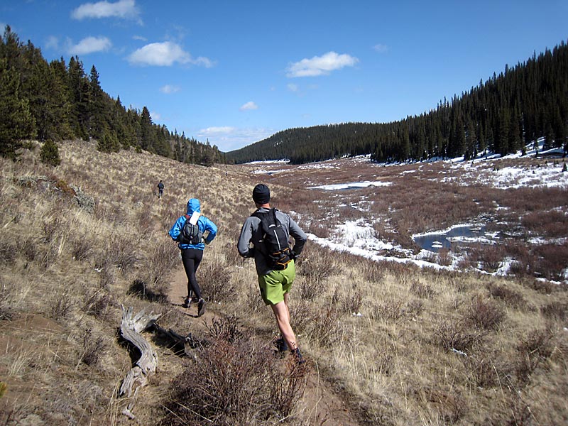
After a quick snack and photos on the summit of Point 11,130', we dropped off the north side and headed north-northeast, aiming for the headwaters of the North Fork of Lost Creek. After floundering in deep snow for another 0.5 miles (and 30 minutes) we popped out into the open grassy area of the Lost Creek valley. We quickly picked up the trail and the thankfully the open treeless valley was 99% snow-free. We picked up the pace and maintained a steady run for the next 7-8 miles until we reached the Lost Creek trailhead at mile 26 of our run and 8 hours of elapsed time from the start. The sign that greeted us said "FS 560 - 8 miles", which was the location of our car. With the trails in the shape they were in, we estimated we'd be done in 80-120 minutes. It was only a quick 2 mile climb to the saddle separating the Lost Creek drainage and the Bluestem drainage, then 6 miles of steady and fast downhill to the car.
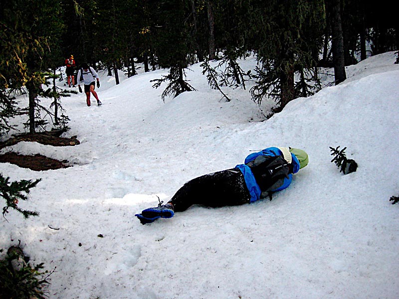
We pushed off with renewed energy, ready to finish off this long day, and we were instantly greeted by deep snow. The climb to the saddle wound up taking nearly and hour in knee-deep soft snow, but we finally made it. At the saddle we were greeted by even deeper snow. Not only was it deeper but it had taken on a malicious consistency in the cooling afternoon: the top was an icy crust that wouldn't hold body weight and that crust was hiding knee to waist deep unconsolidated sugar snow underneath. We wallowed at an agonizingly slow pace through the snow, aware that we were down to about 2-2.5 hours of daylight with 6 miles to go and moving at less than 1mph. Not only were we running out of daylight, but like total idiots all of us but Charles had done the run without a flashlight.
At some point, we became separated from Mike, who had cut due east looking for a way out of the snow. We thought he was with us and he thought we were with him. Within minutes he was completely out of sight and voice contact. We hollered for him for 15 minutes or so, as we wallowed around trying to pick up his track, but to no avail. With only 2 hours of light remaining and one headlight the decision was made to leave Mike, cut away from the CT and down and across the Bluestem drainage. My thought was that as we crossed over to the south facing slopes the snow would lessen. Thankfully, that thought was right and the snow immediately disappeared. Joe, Tressa, Charles and I began quickly sidehilling down the ever-steepening drainage. On my mind the entire time was that not only did we only have one light, but we had no matches or lighter and the prospect of spending the night out at 10,000' was rapidly becoming a realistic possibility. Thankfully the four of us had plenty of clothes to survive a night, but Mike went super light, and only had shorts, one long sleeve shirt, gloves and a light hat. A night out in the snow would almost certainly kill him. I mentioned how stupid it was that we all left without the "Ten Essentials" and Joe mentioned that he did have a lighter.
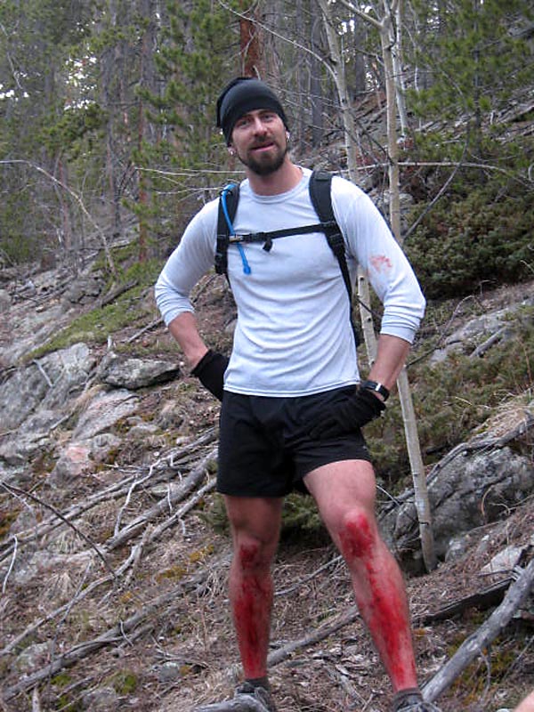
At this point, I knew the four of us would comfortably survive the night since we had a heat source, if it came to that, but I was starting to get pretty worried about Mike. He was totally MIA and constant attempts to make voice contact with him across the valley failed. Charles, Joe, Tressa, and I formulated a plan: We'd follow the Bluestem drainage until we could get a cell signal, at which point we'd call a half-dozen friends and have them quickly assemble rescue gear and head to the trailhead, where we would rendezvous with them and head back up and look for Mike. We considered calling SAR (Search and Rescue), but SAR's policy is to not dispatch until first light and we didn't think Mike would live to see first light. As we continued our rapid bushwhacking descent, we heard a "Hey, hey, holy shit" and turned back to see Mike, covered in blood from the knees down, running up behind us. He had finally given up on his plan to traverse out and had backtracked and followed our footprints down through the snow and joined our bushwhack out. At this point, we knew we'd all comfortably survive the night and the mood quickly lightened. The sun set around this point and we were now working only with twilight. We figured we had under an hour to navigate, sans lights.
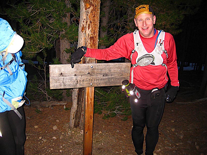
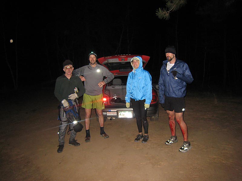
Joe noticed on his GPS that a trail would intersect out path in the next mile or two. We picked up the pace and ran down until we hit the Payne Creek Trail. From here we could climb 1.5 miles back up to the Colorado Trail and then finish off the final 3 mile descent to the car. A trail is easy to follow, even in the dark, even with just one light for five people, but it would be slow going. We wanted to put as much trail behind us as we could before it got completely dark so we pushed the pace up the climb until we hit the CT. Once there, we topped off the fuel tanks and began the run to the car. We had about 25 minutes to run 3 miles before total darkness set in. Tressa, Joe, and I rolled into the Rollins Creek trailhead parking lot, without a light, as the very last photons of the day left the sky. Charles and Mike arrived about 5 minutes later with the aid of Charles' light. We hiked the last 0.5 miles of gravel road without lights, under the bright quarter moon, to the car and the epic ordeal was over with everyone safe and sound. We drove back to Kenosha Pass to pick up Tressa's car and then made the uneventful and warm drive back home, where we arrived at nearly midnight. Tressa missed her engagement in Denver :)
The main reason I'm writing this trip report is so I can put down in print what we did wrong and what we did right to get out of the situation we had created for ourselves.
What we did wrong. Our mistakes were cascading, and started with the initial wrong turn at the very start. I'm an excellent navigator, as is Charles (and I suspect Joe), and a quick glance at the map would have shown right away that the advice we received at the start was bad. Instead of double-checking their information, we accepted and blindly headed off. This was a mistake, though not a bad one. It did cost us an hour and 4 miles. That hour would have been handy at the end of the day! Our HUGE mistake was that each person failed to carry the full Ten Essentials, including a light. I (and I probably speak for everyone else too) left my flashlight behind in the car because I expected the run to take 6-7 hours. That would have left us with a 5-6 hour cushion of daylight... no problem right? Apparently not. No matter how fit and fast you are, when the sun sets you're done for the night unless you have a light source. Leaving behind the rest of the Ten Essentials was an oversight on my part... I usually pack them in a tiny stuff sack, but today I was rushed and left about half the items behind, including the lighter and compass (though I had a GPS). Splitting up was, in my opinion, the biggest mistake we made, even though at the time it was unintentional. How quickly we lost voice and sight contact was frightening. Having one person stranded, alone, with no survival gear, was very bad.
The lesson that I learned from this experience is that even if it's a popular well-marked trail, when you run a huge stretch of it you can't anticipate everything that will happen in regards to fitness, trail conditions, or accidents. From now own, I will ALWAYS CARRY A LIGHT, ENOUGH CLOTHING TO SURVIVE, AND THE FULL TEN ESSENTIALS. Had anything gone slightly more wrong, this great epic story may have had a very bad ending. It's not worth saving 10 ounces to leave behind critical survival gear!
What we did wrong:
What we did right. When we lost Mike and things really started to go south, we made a lot of quick and correct decisions. Crossing over to the south facing slope, even though it was a total pain to do, was a VERY GOOD idea. Our speed went from 1mph to 4mph as soon as we left the snow. Our navigation skills were excellent. We always knew exactly where we were. Had we not brought the USGS 7.5 min topos and GPS (or compass) we would have been completely screwed and flying blind. With the maps we came out within 50 FEET of confluence of two creeks where we planned to pick up the Payne Creek Trail. Our navigation was spot on and saved us a lot of time. Joe brought a lighter. That one ounce lighter changed the entire scenario from potentially dire, to just a warm inconvenient night out in the woods.
What we did right:
The Ten Essentials:
Hopefully our lesson in stupidity will at least prove useful to somebody out there reading this. Bring the ten essentials and a light!!
|
|
Copyright © 2003-2012 - Chris Gerber
|